About PROWL

PROWL

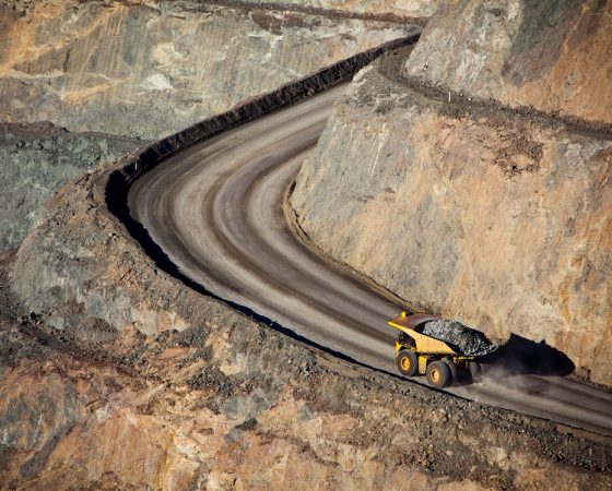
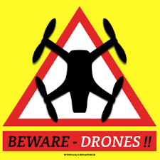
The Planning and Routing Object Warning Locator service aims to provide the GPS location of all physical hazards and objects in the world.


The system offers access to multiple reference sources of GPS encoded polygons that represent buildings, topographical features, trees, hazards and no-fly zones – to name just a few. These hazard references can be leveraged by planning software to create a safe route for automated vehicles – avoiding vehicle loss and damage, reducing the risk of vehicle collision with structures and objects, and complying with flight exclusions and requests for privacy.

When users upload GPS polygons or point clouds to the system, they are compared to existing objects in the database, and AI is used to identify any improvements that the new data can provide to the objects in the database. This allows the system to improve constantly. AI also identifies likely errors, corruption or deliberate tampering, to ensure the validity and trust in the data.

It’s crowd sourced, extensible, constantly evolving and capable of doing much more. Each object can be tagged with any textual information – this could include data such as the owner of the object data, tree species and the council or company responsible for maintaining it, the construction date and architect / owner of a building, when a power line was last inspected and by which company, the date that a construction site is licensed to have cranes – the list can be endless.

Learn about the approach to the problem here.

Features

The Drone PROWL system provides GPS polygons of hazards and objects in the real world, so that drones and automated vehicles can avoid them. Privacy requests, no-fly-zones, temporary objects (construction sites, public events), and intermittent hazards such as rail lines – can allow effective route planning.

Extensible

Extensible

The PROWL system is not just one database – it could draw on data from existing sources of geofenced and GPS defined objects – and future ones too! The system has been designed to extend to include new attributes in the database, as well as using a Service Bus to access existing online data repositories.

Data types can be extended with additional tags, such as when the object was last inspected or maintained. This will allow the system to be used for other purposes, such as a power company recording their power line maintenance, or tree species being monitored for pest outbreaks.

AI can also be used to extrapolate and create synthetic data from partial data submitted to the PROWL system.

Resistant to damage

Resistant to damage

As the content is crowd sourced and overlaid with information from other sources, errors can be removed by users’ feedback and by our own AI processes within the system. Invalid objects can be quickly corrected and/or removed through our proprietary back-end algorithms and quality of the data improves over time.

AI assesses all new objects to ensure that they align with existing known data, and may modify or delete new data to improve the overall database integrity.

Each user’s submissions are tagged, and if a user consistently provides poor data, their past submissions can be reviewed.

Crowd Sourced

Crowd Sourced

Users of the system can submit new polygons in return for a credit for their own future access the system. If a user finds that an object reference is inaccurate or wrong, they can submit a new object polygon, which the PROWL system will over-lay with existing data, and then our proprietary code enhances the quality of the overall data. For each unique and valid object a user supplies, they are rewarded with a defined amount of free lookups against the system.

Additionally, through arrangements with third party data sources, even more quality and data can be leveraged.

The Future

The Future

It doesn’t just stop at Drones – PROWL is applicable for autonomous cars, augmented reality, survey and analysis. A database of the GPS location of all physical objects is the aim – and with crowd sourced and extensible data sources, it can only get better!

With our extensible and flexible design and architecture, the PROWL system is able to adapt and extend, leveraging our custom back-end capabilities to enhance on existing data for new purposes.

Future aspirations are to accept SLAM / RTK / point-cloud data to process on our systems to create public models and maps through AI analysis.

Simple or Complex

Simple or Complex

Each polygon to represent an object can have multiple vertices – each one with it’s own GPS coordinates. The more GPS points the object has, the more accurate it is. A simple tower block will be simpler than an big old tree in a field, or a sports stadium. Ground level points are potentially the simplest object in the PROWL system.

Categorised Content

Categorised Content

Each object in the PROWL database is categorised so that your planning software can take into account the requirements of each hazard. Each polygon object has a hazard category, and can have hundreds of tags – including the owner of the virtual object, the owner of the physical object, what source or which user provided the object, when the object will expire, even the type of tree!

Applications

Target uses for the PROWL system

Here are just a few of the potential uses for the PROWL system. Is there anything it will not do?

  • All
  • Capabilities
Hobby drone operators

Hobby drone operators

Operators of small and recreational drones may be unaware of regulations and laws, and would not know of all the no-fly areas or people who have requested privacy over their proper...
Detail
Delivery drones

Delivery drones

Automated flight without line of sight piloting will be possible with the PROWL system, where the delivery drone can take a planned route that can be more certain of avoiding obsta...
Detail
Infrastructure Surveys

Infrastructure Surveys

Commercial Drone operators can use the PROWL system for observing infrastructure such as power lines, pipelines, tracks and fences - whilst the drone is observing the infrastructur...
Detail
Agriculture and Forestry surveys

Agriculture and Forestry surveys

Use the PROWL system to support your planning of getting from field to field without encountering unexpected objects such as trees and power lines. Stock and agriculture farmers, f...
Detail
Mining and world surveys

Mining and world surveys

Surveys of topology can require that a drone flies in a programmed survey grid pattern. Systematic flight plans need to be automated, but there is always the risk that the drone co...
Detail
Driverless transport

Driverless transport

Driverless transport; flying or driving – being aware of hazards and objects to allow planning (but not replace realtime object detection). Using the PROWL system, vehicles can be ...
Detail
Drone exclusion and privacy

Drone exclusion and privacy

Some commonly raised concern about drones are that they go where they are not wanted - entering dangerous no-fly zones near airports and breaching people's privacy. Drone operators...
Detail
Augmented reality

Augmented reality

With PROWL being able to reveal where real-world objects are - ‘skinning’ of real-world objects can be done, to create an augmented reality, such as putting a castle wall texture o...
Detail
Emergency Services

Emergency Services

We've all seen it - police and fire engines racing down the streets, weaving through (or competing with) traffic - and they don't know what they are going to get until they get the...
Detail
Military applications

Military applications

With the increase in usage of drones for military intelligence and offensive usage, the PROWL system has obvious applications. To have a detailed map of physical objects in the wor...
Detail

The PROWL difference

PROWL is unique in the market because it fuses data from multiple sources with AI, to create lightweight and fast access to the object data.

Crowd sourced data is submitted by users, such as; new objects in the world, improved accuracy overlaid on existing objects, requests for privacy, temporary exclusion zones, or additional tags on existing objects. Multiple users can submit data about the same object, further improving the accuracy of PROWL.

Reference data from public and free sources can be analysed to provide a baseline or trusted source of objects and hazards, including official data such as no-fly-zones around airports, schools, and stadiums. Additional sources can be referenced at any time.

AI fuses trusted reference data with crowd-sourced data submissions, removing errors and improving accuracy and data quality. With each new submission or reference data point, AI will evaluate the most accurate points.

Fast and lightweight communication allows drones to access the data directly, even if they have slow Internet access and limited processing power. Using NoSQL databases that are sharded and replicated globally, data submissions can be a “fire and forget” approach where submissions are accepted without confirmation required by PROWL back to a drone.

Would you like more information about PROWL?

Common Questions

Common Questions

The most common questions are:

  • If the system tells people where they cannot fly (privacy requests, no-fly zones), it’s easy to circumvent it by not using the service.
    • Yes, but people will want to use the system for the benefits of avoiding damage or loss, or liability. It’s not meant to limit drones, but to protect them.
  • Can’t you just specify where there are safe flying zones and corridors instead?
    • A big benefit of a drone is that it can go in any direction, and is smaller than a piloted vehicle. If safe zones were provided, it would be more limiting than helpful, and not assist in deliveries, surveys and other uses of drones.
  • You will be tracking my location, I don’t want that.
    • The PROWL system can be accessed from anywhere, and look up any location. You could be physically in Australia and looking up information from Japan.
    • The record of where you have requested a lookup to start from is not part of the hazard database, the position of a drone/user is not part of PROWL. Have a look at what it will not do.
  • This already exists with some drone vendors
    • Some drones have control for mandatory exclusion zones such as airports, but not every object and hazard in the world, and are not updated constantly.
  • The information already exists in other sources
    • Yes, but they don’t provide it in a way that is easily used for route planning. Without the PROWL system, you would need to look up airports and privacy requests and buildings and trees and schools/hospitals – and work out the combination of hazards for yourself.
    • There are other providers such as Google, OpenStreetMap, Esri – which can be used as additional data sources to augment or validate information, but they do not have the information about no-fly zones, privacy requests, overhead power lines, temporary hazards such as construction cranes, etc. Only PROWL offers this.
  • Can’t I just get all the data downloaded for me to keep on a database of my own?
    • That would be out of date as soon as it is downloaded, not able to be improved by users from around the world, and not include the whole planet of data!
  • GPS is not accurate enough
    • It doesn’t need to be – the PROWL data helps in planning a route, and your chosen planning software can take into account any requirement for error acceptance. Your software is planning a route around hazards, trying to avoid them by as much distance as practical.
    • GPS technology, augmented with accelerometer and motion detection, will improve GPS accuracy in the future.

More questions? Post them in the Contact box below.

Multi-object simplification

Multi-object simplification

Multi-object simplification is the core to the accuracy of user-submitted content in the PROWL system. Using this approach, poor data submissions can be corrected or rejected, leading to a higher quality of data content.

Using AI, polygons are enumerated based on a number of variables to ensure that invalid polygons are excluded, and that outlying datapoints are pruned. The variables that are used to inform the AI in it’s evaluation of polygons and datapoints include;

  • The trust level of the source user – how many valid objects they have submitted in the past
  • The trust level of the source data – such as from a mapping company vs a council
  • The number of correlations between existing user-submitted polygons
  • The potential for GPS inaccuracies that may skew data consistently in one direction
  • Relationships between the submitted data and external sources of data – such as topography or 3rd party 3D model data sources
  • The source of the user-submitted data; was it from a drone’s sensors, through flight planning software, through the web form, through 3D modelling software etc.
  • Extrapolation of the polygon model shape based on the categorisation type – a long, thin object used to represent a wire type, as opposed to a block object representing a building type.
  • AI interpretation of interpolations and extrapolations of the likely location of objects and data
  • Other patent-pending approaches and analysis methods
Investors

Investors

The drone PROWL project is just coming out of Stealth mode at the moment. However, help and advice is always appreciated.

If you are interested in any of the following, please get in touch with the Contact Us form below;

  • Investment in PROWL
  • Offer to work with us for a great solution (we need web developers, ESB experience, NoSQL developers, GeoJSON architects, and many more)
  • Ideas and suggestions on how we can be better
  • Offers of donations :) or referral to grants, angel investors or seed funding
  • Offering of free services, advice and assistance to make PROWL great
Object Categorisation

Object Categorisation

The PROWL system uses a simple categorisation system to identify what real-world objects are. The category is assigned as a single letter to each polygon object, and groups objects into a type that indicates how it should be handled.

Stationary objects such as buildings are grouped together – these objects are unlikely to move, and so a drone can get relatively close to them. When the database is cleansed, small differences are tolerated between user-submitted objects and the existing data in the PROWL database.

Objects such as wires and trees can be moved by the wind, and so a wider recommended distance is given. When object simplification is performed, a larger tolerance of differences between crowd-sourced data is allowed.

Some objects are categorised as having an expiry date – such as requests for privacy. This expiry date limits data corruption or injection problems, and issues related to temporary changes.

Object categorisation techniques also assist with object simplification; where a stationary object – such as a bridge – and a corridor object – such as a rail line – can be interpreted as not being able to intersect. In this example, if there were multiple user submissions of the bridge object, then the polygons submitted can be simplified to make the bridge model more accurate, but would not be combined with the rail corridor object.

Each object is also assigned a unique ID, the submission date and the submitter username (or source) is recorded as the object owner. This allows the object to be removed by the owner, external data ownership to be retained, and trends in invalid data submissions to be tracked.

Contact Us

Do you have a question? A comment to make? Would you like to provide some feedback or have some ideas to make PROWL a better service?

Would you like to make investment enquiries or offer your services as a developer? Tweeting @DroneProwl too public for you?

Get in touch through this form below